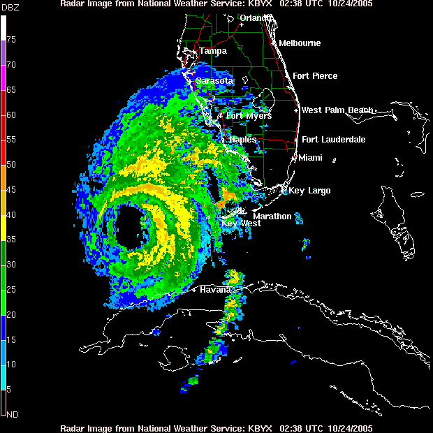
The storm is just shy of being a Category 3 hurricane, and there is a good possibility that it might make that before landfall.
The storm looks like it's going northeast, and should hit around Naples on that map. If you look at that map, there are two red lines that cross the green county line between Miami and Ft. Lauderdale. My house is essentiall where the left most red line meets the green line. On that path, the eye will be north of my house by about 15-20 miles (my estimate), putting us squarely in the hurricane wind path. Fun fun fun!

No comments:
Post a Comment